 Say Owee to Adventure!
7/27 '24
Say Owee to Adventure!
7/27 '24
So. Went for a hike a couple days ago. Target: the Motion Path portion of the East Coast Trail, a 13.8k “moderate to difficult” hike from Petty Harbour to Bay Bulls. (Or is it?...)
We’ve had a dry spell: terrific for hiking, as most of the nearby woodland trails include “prominent water features” (low areas that with a drop of rain become virtual ponds due to adjacent bogs) requiring waterproof-to-shin-height footwear, off-roading into thick, pointy brush to skirt the flooded patches, or the soul of a duck to endure. And the “heat” had broken, with an expected high of 22C/72F. Dry! Cool! Nice! Perfect, even!
I’m a soft old man, but I do likes a hike. Even the trails closest to town don’t disappoint. I’ve done the Quidi Vidi (southern) half of the Sugarloaf Path (view here) and the South Side Hills (western) half of the Deadmans Bay Path a few times. But why “halfsies”? Ah.
For those out for casual day hikes, the main concern is transportation to/from the trailheads. Metrobus (the only regional service) is limited to the St. John’s and Mount Pearl areas, so for trails that go beyond you must be willing to hike a round trip to your car or arrange private transportation to/from at least one end. I’ve gotten around this a bit by exploiting the Route 18 bus, which does dip its toe out of the metro area, specifically with stops in Kilbride and The Goulds. (I’ve also done the easternmost portion of the tRailway walk a few times, as far as the Double Ice Complex in Paradise, where I can get a Rte 30 home; this bus only runs in the early morning and late afternoon, so I have to time my walks appropriately. West of this, there’s no public transit option.)
I learned to use the Kilbride stop after my first attempt at walking Old Petty Harbour Rd down to, you guessed it, Petty Harbour, with the intention of having a mooseburger and beer at Chafe’s Landing, then either reversing the trip or walking the main road out to the highway, both of which get me to the bus. Of course, I didn’t use the bus that time, but instead walked from our old address to the trail, adding six uphill kms. The first and last thirds of the trail are kinda groomed, more like access roads. The middle part, what I call the Mud Flats, a brown patch visible from space that is a lot of fun for ATVs and zero fun for hikers, is where I lost the trail. (Even now, after making the walk a few times, it’s still hard to find the proper way through that muck.) Not believing they’d “force” anyone to cross that barren oozing zone, I stayed west and climbed a ridge, learning too late that I had found a beautiful dead end. (The ending “dot” here is where I wound up, but the blue line wasn’t how; I followed the trail between the dot and the start of the blue line to the north.) Very tired, kinda frustrated and hungry, and realizing that doubling back would cost at least forty minutes, I decided it would be "better" to get down off that ridge through the “wilderness”. Oy. It took me an hour of pushing downhill through brush, jumping across the same stream more than once, ducking branches, and some light bouldering to get to the bottom, then almost going on all fours under that big pipe, then a scramble up to the road. That still left 5k (gently uphill) to the highway bus stop. It was around 3:30pm by then, and the sun was barely over the hills. Did I mention this was December and the temp was just above freezing? I almost called Michele for a rescue. I was soaked through with sweat (undershirt, shirt, jacket liner, and jacket), and by the time I got to the bus stop I had trouble walking and was shivering uncontrollably, possibly entering hypothermia. Can't imagine how I smelled. Total distance about 17.5k, total elevation gain about 280m, duration around 6 hours, calories burned approaching 1400 thanks to the pioneering, total IQ loss about 8, also thanks to the pioneering.
This wasn’t the first dumbass hiking move I’d made. No, that would be the “easier” round trip that was closest to our house, part of the Deadmans Bay Path. Eagle-eyed folks clicking that link will note that the total elevation gain is 419m; this is actually two climbs of 210m, and two descents. I went north first, to the trailhead by Fort Amherst, from where it’s a whole lot of rocky wooded steepness up to the top of Cahill Point and the Big Dam (spoiler: it’s not very big). The descent to Freshwater Bay is just as steep, almost treacherous in places, and maybe harder to navigate down than up (as I would learn later, when I did this trip in reverse). I didn’t go further than the Bay because, again, there’d be no convenient transportation back, so I headed up toward Shea Heights, a distinct neighbourhood on a ridge above the city, an easier leg and not so steep, but uphill all the way. This was summer, so no hypothermia, but I wasn’t prepared for the climb, the UV, or the heat (it was more like 25C/77F; I’m sensitive, okay!); by the time I reached the base of our street, looking at that slope, I pretty much figured I’d call a cab for that last half block. This excursion taught me the value of naproxen. But it didn’t teach me much else, it seemed.
(Technically, the first stupid hike would be fifteen years ago, an ill-conceived all-day walk in new shoes. I lost two toenails. But I’m much better now.)
I’m often guilty of overthinking, over-packing, and over-preparing; every trip to the States is an exercise in stuffing my soft suitcase until it's rigid. But, weirdly, I’m also often guilty of misunderestimating (“For Buddhism, see Buddhism”) the difficulty or scope of an exercise, especially when it’s, you know, exercise. Despite carrying too many pounds and not pumping great cardio, I look at the mileage and think, “No problem!” I pack a light bag that could be lighter if I didn’t overthink it (did I really need to bring a poncho? An emergency whistle? A change of shirt and socks? Mints?), but not pragmatic stuff like, oh, say, a hat, sunscreen or bug repellent. Really, do I need a hat when it’s cool out? Like: the fuck, guy. Enjoying your first visit to Earth?
These were several years ago. Before Covid, in fact. Since then I’ve done the proper trek to Chafe’s Landing, and the reverse Deadmans Bay, without ado. I’ve driven to Bay Bulls a few times to make a round trip to the lighthouse (which Google can’t calculate because much of the East Coast trail isn’t on the map for some reason). I push myself a little because it's good for me, and I enjoy hiking, but have managed to not go too far again.
That was, until...
There was no real hike last year; I was involved in an occupational training program and short-term work contract that kept me at a desk seventy hrs/week from the end of June through mid-November. Immediately afterwards we were getting ready to move to our new digs, so my time was spent packing and organizing. Then there was the move itself before winter reamed us, so my exercise until March was moving boxes and literal tons of snow. I did get a few walks in mid-June 2023, but nothing big. I’ve been jonesin’ for an excursion, and had one specifically in mind: the Motion Path.
I’d gotten close before. I’ve taken the 18 bus to the Goulds and walked both Shoal Bay Rd and Pipeline Rd to the coast to pick up the trail northeast, heading toward Petty Harbour and my mooseburger. But I haven’t been able to spot the Trail from there. Looking north there are rocky cliffs, so the trail must go up, not around the point at sea level. Where did it connect? I know it does, ‘cause the East Coast Trail people mention these roads as ways for folks to enter the Trail. Even Google notes it, though it doesn’t map the Trail itself. Did I miss a branch somewhere uphill? There aren’t any markers around the rocks, so...huh? I never did find it. So I figured the only way to work it is to start in Petty Harbour where the trailhead is grandly stated, and head south to Pipeline Rd.; thereafter, I’d know how it’s done, so I could start south next time. Cool!
Per the East Coast Trail site, the Motion Path to Bay Bulls is a “moderate to difficult” 13.8km. But I’d only be doing about 40% of that. Pipeline Rd itself is about 5.5km, half of which is up, but okay. I could take the bus to the road that leads to Petty Harbour, then walk the 5km in, but walking the roadside is kinda dull, and I already know the 8km Old Petty Harbour Rd, which is a bit more interesting and pretty easy. So I figure the real trick will be that climb from sea level up to the top of the hills at Petty Harbour (200m or so), which is about 90 mins into the trip. That’ll be tough, but I’ve got all day. Then it’s roughly, what, 6km of coastal highland vistas before descending to sea level and the Pipeline Rd. Roughly 20km total, much of it easy, only some of which is ascent, including one steeper climb. Okay! I got this!
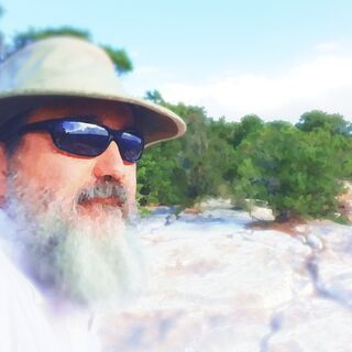
I packed two granola bars, an apple, a banana, a litre of weakly-flavoured Crystal Light (because plain water sucks) and a half litre of cold coffee (mmm!). There’s a convenience store near the Petty Harbour trailhead, so I can stop for an extra snack or drink if I feel like it. Clear sky, relatively cool with some fog hanging about the coast – what else do I need? Oh, yeah: my prescription sunglasses! (Progressives, so it takes a few minutes to find where my legs end, but it’ll be fine after that.) I took a naproxen before leaving the house, and brought one to take with lunch. Smart, smart. What else... Nothing! Nothing, I say!
No hat. No insect repellent. And this is where misunderestimation and NOT USING MY EYES collide.
See, the 13.8km, 5-8 hour “moderate to difficult” Motion Path from Petty Harbour is NOT all the way to Bay Bulls. No, AS IT’S CLEARLY STATED ON THE EAST COAST TRAIL WEBSITE, it’s only to Shoal Bay Rd; the distinct path from there to Bay Bulls is an “extreme” hike of 16km. Which means I’m not doing 40% of the 13.8km – I’m doing the hardest 90% of it, an extra 6+km. Also, and I can't overstate this, I misunderestimated what was deemed "difficult."
I got off the bus in Kilbride about 10:10am. Ate my apple an hour into the first leg. Had a granola bar, my second naproxen, and the last of my coffee in Petty Harbour (where I got this sample view of the height I was about to climb, and yes, those are wisps of fog there), and set off for the trailhead with a song in my heart and smile in mind, but without stopping at the convenience store. I was fine, after all. The climb wasn’t any worse than the one by Fort Amherst, so okay. After taking this video of the fog-lapped overworld, (please forgive the sketchy tweening text; it’s my first go at Davinci Resolve), where you can hear me huffing and puffing, I took my first swig of “drank” (as Michele calls my artificial flavour crap). It was 12:25pm when I set off south.
The stupid-ass Trail doesn’t stay at the top of the coastal hills; it goes down to just above sea level, again and again. And this goat-humping path isn’t just meandering, it follows every contour of the coastline. This includes ascents and descents through angry, spiky evergreens (at least I wore jeans, not shorts!) and dense brush where you can’t see your feet, but where you do find roots, divots, and sudden steps down disguised by the greenery. I mean, it’s like a fucking hike all of a sudden.
I snapped more pics as I went (soon to be posted to FB and IG), but stopped when I was wearing out and becoming concerned I had made a mistake somewhere in the process; the trail just seemed to keep going and going, Pipeline Rd always beyond the next inlet, and I couldn’t be sure whether I was past the point of no return to Petty Harbour. Down to near the water. Up. Down again. Up. I never noticed my skin turning red, but did put my extra shirt over my head because every time I stopped, which was with increasing frequency, the flies and mosquitoes would pester me. Really, it was the bugs that kept my motivation up. No cell signal. I ate my food, started rationing my “drank”. I thought, “Well, this is where I live now, at the top of the world, eating frogs and drinking whatever rain and dew I can collect until Michele calls 911 for search and rescue.”
When I met two hikers going the opposite way, I put on a brave red face and ensured the length of my penis by saying I was doing great. They seemed impressed that I’d walked from Kilbride – they with their big backpacks and coming from Bay Bulls only what, 8km away (?), those fit young bastards. They had a trail map, and said I was about 1km from Pipeline. Huzzah! But that last kilometre? Sucked. The hardest part since the initial climb; in some places, a dip in the foliage canopy was the only hint of a trail. Mud, fording streams, drops that required hands, the whole shtick. When I made it to Pipeline I could see that the trail really is invisible from there. Consarnit.
I was spent. Breathing hard for the last hour, soaked through, two swallows of “drank” left, leaden feet, sore everything despite the naproxen, somehow famished, 5km to go, half of it uphill another 150m, and two hours behind schedule. And two ponded washouts to avoid via rough woodland passage. I stopped often, and remain surprised that I kept going; I badly wanted to call it. It’s the second most exhausted I’ve been, topped only by that hypothermic experience. Fortune smiled on me then, for the bus arrived minutes after I got to the stop; 6:18pm, sun still high-ish. An unexpectedly eight hour day (minus breaks, obvs).
I felt stupid and shitty. And I’m comically red, including under my thinning hair. Had I not learned? The hell! I know I’m out of practice, but how am I so destroyed when two thirds of this trip were familiar and relatively easy trails? Did I really lose so much stamina, so much health, in the last year? Is this what aging really feel like? ‘Cause fuck this shit.
I solved the mileage mystery the next day, and realized I had in fact done a lot more than planned, or would have planned: an estimated 28km, an accumulated ascent of 700+m, 1900 calories burned, IQ -12. So now I’m also kinda proud, in a stupid way. This turns out to be the second longest “straight-through” walk/hike of my life. The longest was an 18-mile (29km) charity walk-a-thon when I was 17. FORTY YEARS AGO. Don’t get me wrong; I’m not fit, not even for my age, I think. But goddammit if I didn’t do 17 miles, including some for-realz hiking, after five months on my ass. I’m paying for the lack of prep, but yeah. I did the thing.
Lesson learned? I wish!
However, it does make clear that my to-do list hike from Petty Harbour to Bay Bulls (or reverse, for the mooseburger) is not to be taken lightly or without more conditioning. The combined Motion Path and Spout Path are 30km of moderate to “extreme” trail, estimated travel of 11-16 hours. There’s no bus close to Bay Bulls, and getting to Petty Harbour requires at least a 5k walk from a stop; better to coax Michele into driving my ass to and from. There are two campsites along the way, with no open fires allowed, which would mean toting camp stoves or ready-to-eat food along with a tent, hammock, or whatever. Sounds dreamy, sorta, but I don’t know when I’ll be ready for that commitment.
But I do know: time’s a-wasting.
Now: more moisturizer before my skin comes off in scales.
But what I really want to know is: what’s a moose burger like?